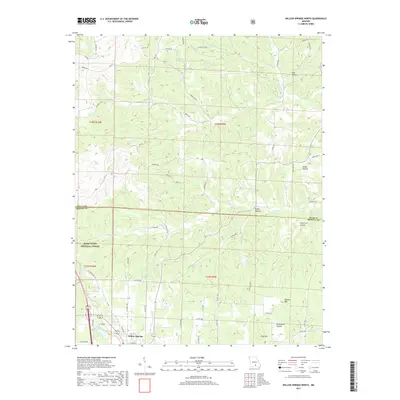
2017 Map of Willow Springs North
USGS Topo · Published 2017About this map
Willow Springs sits at the southern edge of this Ozark landscape, where the northern reaches of the town meet the forested hills of the Mark Twain National Forest. The topography is defined by a dense network of hollows, including Richardson Hollow, Rebel Hollow, and Spout Spr Hollow, which drain toward significant watercourses like the Eleven Point River and the S Prong Jacks Fork. To the south, Queens Mtn and King Mtn provide prominent relief above the surrounding valleys. Local water management and recreation are evident in the presence of Frisco Reservoir and Little Cannon Lake, while the boundary between Texas and Howell counties bisects the northern section. This 2017 survey reflects a region where established rural road networks like Old Springfield Rd and Old Rolla Rd connect isolated homesteads and forest tracts to the regional hub at Willow Springs.
Find a feature on this map
65 named features on this map. Tap any name to fly to it.
Don’t see what you’re looking for? This feature index may not catch every label — zoom into the map to look around manually.
Map Details
Editions of this 2017 Willow Springs North Map
This is the sole edition of this map. No revisions or reprints were ever made.
Other maps of this area

1939 · Topaz
USGS Topo · 1:62,500

1941 · Topaz
USGS Topo · 1:62,500

1945 · Harrison
USGS Topo · 1:250,000

1945 · Willow Springs
USGS Topo · 1:62,500

1945 · Clear Springs
USGS Topo · 1:62,500

1948 · Clear Springs
USGS Topo · 1:62,500

1948 · Willow Springs
USGS Topo · 1:62,500

1949 · Harrison
USGS Topo · 1:250,000

1949 · Rolla
USGS Topo · 1:250,000

1951 · Cabool SE
USGS Topo · 1:24,000