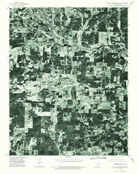
1976 Map of Willow Springs NW
USGS Topo · Published 1977About this map
Willow Springs sits at the northwestern edge of this 1976 orthophotoquad, serving as a focal point for the surrounding rural landscape of Howell County. Captured through aerial photography from the mid-1970s, the map reveals a patchwork of cleared agricultural land and dense wooded plots typical of this portion of the Ozark Plateau. Small rural settlements like Hutton Valley and Burnham appear as distinct clusters among the network of country roads and farmsteads. The orthophoto format provides an unique look at the land use patterns and forest cover of the era, offering researchers a realistic visual of the terrain that standard topographic lines cannot convey. This imagery allows for the tracing of old fence lines, woodland borders, and the specific footprints of farm buildings as they existed decades ago.
Find a feature on this map
3 named features on this map. Tap any name to fly to it.
Don’t see what you’re looking for? This feature index may not catch every label — zoom into the map to look around manually.
Map Details
Editions of this 1976 Willow Springs NW Map
This is the sole edition of this map. No revisions or reprints were ever made.
Other maps of this area

1939 · Topaz
USGS Topo · 1:62,500

1941 · Topaz
USGS Topo · 1:62,500

1945 · Harrison
USGS Topo · 1:250,000

1945 · Willow Springs
USGS Topo · 1:62,500

1945 · Clear Springs
USGS Topo · 1:62,500

1948 · Clear Springs
USGS Topo · 1:62,500

1948 · Willow Springs
USGS Topo · 1:62,500

1949 · Harrison
USGS Topo · 1:250,000

1949 · Rolla
USGS Topo · 1:250,000

1951 · Cabool SE
USGS Topo · 1:24,000