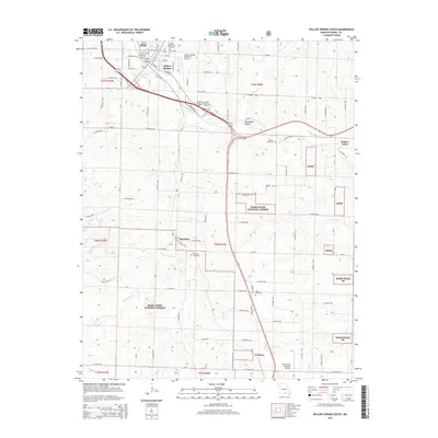
2015 Map of Willow Springs South
USGS Topo · Published 2015About this map
Willow Springs sits at the intersection of significant transit corridors in northern Howell County, serving as a hub where the Eleven Point River begins its course through the Ozarks. The landscape here is defined by a transition from the structured street grid of the town to the protected woodlands of the Mark Twain National Forest, which dominates much of the southern and eastern portions of the quadrangle. Small agricultural and residential clusters like Burnham, Pomona, and Hutton Valley are connected by a network of county roads, reflecting a decentralized settlement pattern common to this part of Missouri. Aviation history is visible through the presence of both the Willow Springs Memorial Airport and the West Plains Regional Airport. Genealogists will find several burial sites including Willow Springs City Cemetery and the more remote Moffett Graveyard, while watercourses like Lost Camp Cr and S Fork Spring Cr carve through the local topography.
Find a feature on this map
73 named features on this map. Tap any name to fly to it.
Don’t see what you’re looking for? This feature index may not catch every label — zoom into the map to look around manually.
Map Details
Editions of this 2015 Willow Springs South Map
This is the sole edition of this map. No revisions or reprints were ever made.
Other maps of this area

1939 · Topaz
USGS Topo · 1:62,500

1941 · Topaz
USGS Topo · 1:62,500

1945 · Harrison
USGS Topo · 1:250,000

1945 · Willow Springs
USGS Topo · 1:62,500

1945 · Clear Springs
USGS Topo · 1:62,500

1948 · Clear Springs
USGS Topo · 1:62,500

1948 · Willow Springs
USGS Topo · 1:62,500

1949 · Harrison
USGS Topo · 1:250,000

1949 · Rolla
USGS Topo · 1:250,000

1951 · Cabool SE
USGS Topo · 1:24,000