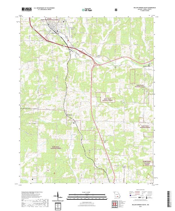
2021 Map of Willow Springs South
USGS Topo · Published 2021About this map
Willow Springs serves as the primary hub of this landscape, situated at the edge of the Mark Twain National Forest. The map documents a transition from the town's street grid—notably including E Main St and S Center St—into the rolling drainage basins of the Eleven Point River and Lost Camp Cr. Smaller settlements like Burnham and Hutton Valley are captured with their associated family and community burial grounds, such as the Burnham Cem and Hutton Valley Cem. Aviation history is well-represented here, with both the Willow Springs Memorial Airport and the West Plains Regional Airport shown. The presence of numerous cemeteries like Moffitt Cem and Harris Cem provides essential spatial data for genealogists tracing Ozark family history through these rural communities and former railroad corridors.
Find a feature on this map
41 named features on this map. Tap any name to fly to it.
Don’t see what you’re looking for? This feature index may not catch every label — zoom into the map to look around manually.
Map Details
Editions of this 2021 Willow Springs South Map
This is the sole edition of this map. No revisions or reprints were ever made.
Other maps of this area

1939 · Topaz
USGS Topo · 1:62,500

1941 · Topaz
USGS Topo · 1:62,500

1945 · Harrison
USGS Topo · 1:250,000

1945 · Willow Springs
USGS Topo · 1:62,500

1945 · Clear Springs
USGS Topo · 1:62,500

1948 · Clear Springs
USGS Topo · 1:62,500

1948 · Willow Springs
USGS Topo · 1:62,500

1949 · Harrison
USGS Topo · 1:250,000

1949 · Rolla
USGS Topo · 1:250,000

1951 · Cabool SE
USGS Topo · 1:24,000