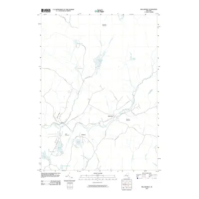
2010 Map of Willowemoc
USGS Topo · Published 2010About this map
Willowemoc Creek and its many tributaries, including Hunter Brook and Fall Brook, define the drainage patterns of this Sullivan County landscape. The settlement of Willowemoc sits at a central junction of roads like Willowemoc Rd and Parksville Rd, while De Bruce and Anderson mark smaller hubs of activity further west. The topography is dominated by peaks such as Mongaup Mountain and Slawson Mountain, creating a basin filled with numerous water bodies. Notably, the northern terrain features a cluster of significant ponds, including Mongaup Pond, Hodge Pond, and Frick Pond. The road network, with names like Brown Settlement Rd and Fluggertown Rd, suggests a history of localized upland farming and residential clusters amidst the Catskill foothills.
Find a feature on this map
53 named features on this map. Tap any name to fly to it.
Don’t see what you’re looking for? This feature index may not catch every label — zoom into the map to look around manually.
Map Details
Editions of this 2010 Willowemoc Map
This is the sole edition of this map. No revisions or reprints were ever made.
Other maps of this area

1901 · Margaretville
USGS Topo · 1:62,500

1904 · Margaretville
USGS Topo · 1:62,500

1910 · Neversink
USGS Topo · 1:62,500

1921 · Livingston Manor
USGS Topo · 1:62,500

1922 · Andes
USGS Topo · 1:62,500

1923 · Livingston Manor
USGS Topo · 1:62,500

1924 · Andes
USGS Topo · 1:62,500

1942 · Neversink
USGS Topo · 1:62,500

1943 · Monticello
USGS Topo · 1:125,000

1944 · Livingston Manor
USGS Topo · 1:62,500