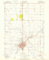
1951 Map of Willows
USGS Topo · Published 1952About this map
Willows serves as a prominent agricultural and administrative hub for the Sacramento Valley in this early 1950s representation. The town’s grid is well-established, anchored by the Court House and City Hall, while its role in regional aviation is marked by the Willows Airport to the west. North of the city, the settlement of Artois sits along the Southern Pacific railroad line, which dictates the layout of local commerce and transport. The landscape is defined by a sophisticated system of irrigation canals and drainage ditches that cut across the natural meanders of Willow Creek and Walker Creek, illustrating the extensive water management required for farming in Glenn Co. Institutional landmarks like the Kanawha School, the County Hosp, and a local Cem provide specific points of interest for genealogists tracing family footprints in the rural areas surrounding the city center.
Find a feature on this map
20 named features on this map. Tap any name to fly to it.
Don’t see what you’re looking for? This feature index may not catch every label — zoom into the map to look around manually.
Map Details
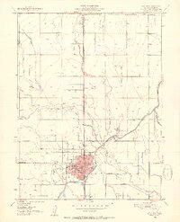
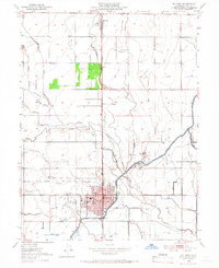
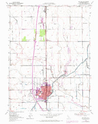
Editions of this 1951 Willows Map
4 editions found
Other maps of this area

1904 · Walker Creek
USGS Topo · 1:31,680

1904 · Logan Creek
USGS Topo · 1:24,000

1906 · Maxwell
USGS Topo · 1:62,500

1906 · Willows
USGS Topo · 1:62,500

1914 · Orland
USGS Topo · 1:31,680

1914 · Hamilton
USGS Topo · 1:31,680

1917 · Kurand
USGS Topo · 1:31,680

1917 · Lyman
USGS Topo · 1:31,680

1917 · Jacinto
USGS Topo · 1:31,680

1917 · Logandale
USGS Topo · 1:31,680