
1949 Map of Willseyville
USGS Topo · Published 1958About this map
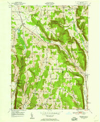
The hills of Danby and Candor dominate this 1940s landscape, defined by steep ridges like Steventown Hill and Durfee Hill that channel the local rail and road networks. The Delaware Lackawanna and Western RR and Lehigh Valley RR trace the valley floor through Willseyville, illustrating the vital rail corridor connecting the Southern Tier to the Finger Lakes region. Small rural hamlets and named hillsides reflect a mid-century community still centered on local institutions, including the Smiley Sch and Morris Chapel Sch.
Find a feature on this map
47 named features on this map. Tap any name to fly to it.
Don’t see what you’re looking for? This feature index may not catch every label — zoom into the map to look around manually.
Map Details
Editions of this 1949 Willseyville Map
2 editions found
Other maps of this area

1893 · Ithaca
USGS Topo · 1:62,500

1895 · Ithaca
USGS Topo · 1:62,500

1900 · Dryden
USGS Topo · 1:62,500

1902 · Waverly
USGS Topo · 1:62,500

1903 · Owego
USGS Topo · 1:62,500

1905 · Watkins Glen
USGS Topo · 1:125,000

1906 · Catatonk
USGS Topo · 1:125,000

1949 · Ithaca West
USGS Topo · 1:24,000

1949 · Ithaca East
USGS Topo · 1:24,000
1949 · Dryden
USGS Topo · 1:24,000