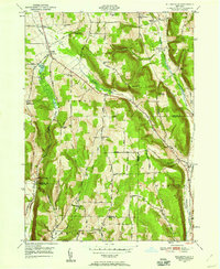
1949 Map of Willseyville
USGS Topo · Published 1967About this map
Danby and the surrounding rural uplands of Tompkins and Tioga counties define this landscape just after the mid-century. The topography is dominated by prominent heights such as Steventown Hill, Durfee Hill, and Roundtop, which dictate the winding paths of rural thoroughfares like Michigan Hollow Road and Hill Road. A distinct collection of neighborhood institutions reflects the decentralized community structure of the era, including the Smiley School, Belle School, and Morris Chapel.
Find a feature on this map
47 named features on this map. Tap any name to fly to it.
Don’t see what you’re looking for? This feature index may not catch every label — zoom into the map to look around manually.
Map Details
Editions of this 1949 Willseyville Map
2 editions found
Other maps of this area

1893 · Ithaca
USGS Topo · 1:62,500

1895 · Ithaca
USGS Topo · 1:62,500

1900 · Dryden
USGS Topo · 1:62,500

1902 · Waverly
USGS Topo · 1:62,500

1903 · Owego
USGS Topo · 1:62,500

1905 · Watkins Glen
USGS Topo · 1:125,000

1906 · Catatonk
USGS Topo · 1:125,000

1949 · Ithaca West
USGS Topo · 1:24,000

1949 · Ithaca East
USGS Topo · 1:24,000

1949 · Willseyville
USGS Topo · 1:24,000