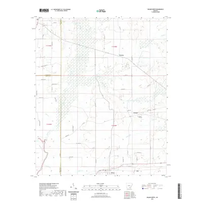
2020 Map of Wilmar North
USGS Topo · Published 2020About this map
Wilmar anchors the southern portion of this landscape where the Saline River and its tributaries carve through the timberlands of Drew, Bradley, and Cleveland counties. The terrain is defined by an intricate network of waterways including Sevenmile Cr, Hudgens Cr, and Langford Cr, which historically shaped the placement of local homesteads and travel routes. Small settlements like Barkada and Brandon are connected by a web of local roads such as Barkada Rd and Sanderlin Rd, indicating a rural community structure centered around agriculture and forestry.
Find a feature on this map
60 named features on this map. Tap any name to fly to it.
Don’t see what you’re looking for? This feature index may not catch every label — zoom into the map to look around manually.
Map Details
Editions of this 2020 Wilmar North Map
This is the sole edition of this map. No revisions or reprints were ever made.
Other maps of this area

1935 · Feenyville
USGS Topo · 1:62,500

1953 · Greenwood
USGS Topo · 1:250,000

1953 · El Dorado
USGS Topo · 1:250,000

1956 · Greenwood
USGS Topo · 1:250,000

1957 · El Dorado
USGS Topo · 1:250,000

1958 · El Dorado
USGS Topo · 1:250,000

1960 · El Dorado
USGS Topo · 1:250,000

1966 · Monticello North
USGS Topo · 1:24,000
1966 · Monticello South
USGS Topo · 1:24,000

1970 · Herbine
USGS Topo · 1:24,000