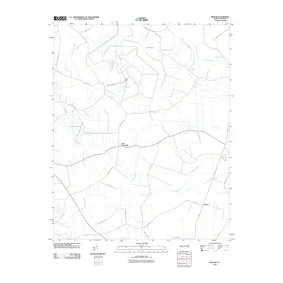
2010 Map of Wilmar
USGS Topo · Published 2010About this map
Wilmar and Elmira Crossroads anchor this eastern North Carolina landscape, where the coastal plain’s drainage patterns dictate the layout of roads and settlements. Broad wetlands like Thorofare Swamp and Creeping Swamp weave between agricultural parcels, creating a distinct mosaic of forest and field. A unique industrial landmark, the Voice of America site, occupies a significant area in the northern portion of the quadrangle, with Voice of America and VOA Site B Rd marking its footprint. Local history is etched into the road network with family-named routes such as Black Jack Simpson Rd, Charlie Williams Rd, and Hubert Boyd Rd connecting small communities across the lowland reaches of Chicod Creek and Polland Swamp.
Find a feature on this map
39 named features on this map. Tap any name to fly to it.
Don’t see what you’re looking for? This feature index may not catch every label — zoom into the map to look around manually.
Map Details
Editions of this 2010 Wilmar Map
This is the sole edition of this map. No revisions or reprints were ever made.
Other maps of this area

1902 · Ayden
USGS Topo · 1:62,500

1902 · Vanceboro
USGS Topo · 1:62,500

1903 · Winterville
USGS Topo · 1:62,500

1903 · Chocowinity
USGS Topo · 1:62,500

1904 · Ayden
USGS Topo · 1:62,500

1904 · Vanceboro
USGS Topo · 1:62,500

1905 · Chocowinity
USGS Topo · 1:62,500

1905 · Winterville
USGS Topo · 1:62,500

1905 · Vanceboro
USGS Topo · 1:62,500

1951 · Hackney
USGS Topo · 1:24,000