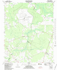
1983 Map of Wilmar
USGS Topo · Published 1983About this map
Voice of America (Site B) dominates the central landscape of this 1983 survey, defined by a massive array of Radio Towers spread across the flat, swampy terrain of the Inner Coastal Plain. This cold-war era broadcasting facility sits at the convergence of three counties—Pitt, Beaufort, and Craven—surrounded by a complex network of seasonal wetlands including Thorofare Swamp, Clayroot Swamp, and Creeping Swamp.
Find a feature on this map
29 named features on this map. Tap any name to fly to it.
Don’t see what you’re looking for? This feature index may not catch every label — zoom into the map to look around manually.
Map Details
Editions of this 1983 Wilmar Map
This is the sole edition of this map. No revisions or reprints were ever made.
Other maps of this area

1902 · Ayden
USGS Topo · 1:62,500

1902 · Vanceboro
USGS Topo · 1:62,500

1903 · Winterville
USGS Topo · 1:62,500

1903 · Chocowinity
USGS Topo · 1:62,500

1904 · Ayden
USGS Topo · 1:62,500

1904 · Vanceboro
USGS Topo · 1:62,500

1905 · Chocowinity
USGS Topo · 1:62,500

1905 · Winterville
USGS Topo · 1:62,500

1905 · Vanceboro
USGS Topo · 1:62,500

1951 · Hackney
USGS Topo · 1:24,000