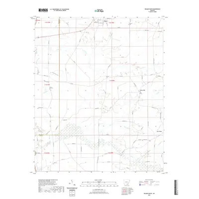
2020 Map of Wilmar South
USGS Topo · Published 2020About this map
The town of Wilmar sits at the northern edge of this survey, where the grid of city streets like Lafoon Ave and Johnson Ave gives way to the dense creek networks and wetlands of southern Drew County. This area is defined by the convergence of Clear Cr, Hazel Cr, and Tenmile Cr, creating a landscape punctuated by numerous family and community burial grounds that reveal the settlement history of the region. Notable sites include the Wilmar Cem and Turner Hills Cem near the town center, while smaller hamlets like Green Hill and New Hope maintain their own distinct identities and namesake cemeteries. The southern portion of the map is dominated by the sprawling wetlands around Clear Cr, through which the historic Warren Prairie Trail once passed, illustrating the historical challenge of navigating this water-rich territory.
Find a feature on this map
81 named features on this map. Tap any name to fly to it.
Don’t see what you’re looking for? This feature index may not catch every label — zoom into the map to look around manually.
Map Details
Editions of this 2020 Wilmar South Map
This is the sole edition of this map. No revisions or reprints were ever made.
Other maps of this area

1934 · Ingalls
USGS Topo · 1:48,000

1937 · Ingalls
USGS Topo · 1:62,500

1939 · Ingalls
USGS Topo · 1:62,500

1953 · Greenwood
USGS Topo · 1:250,000

1953 · El Dorado
USGS Topo · 1:250,000

1956 · Greenwood
USGS Topo · 1:250,000

1957 · El Dorado
USGS Topo · 1:250,000

1958 · El Dorado
USGS Topo · 1:250,000

1960 · El Dorado
USGS Topo · 1:250,000

1966 · Monticello North
USGS Topo · 1:24,000