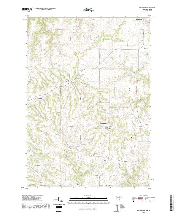
2022 Map of Wilmington
USGS Topo · Published 2022About this map
Wilmington sits at the heart of this Houston County landscape, where the agricultural plateaus of Portland Prairie meet the winding drainage systems of Winnebago Cr and Beaver Cr. The terrain is defined by a network of rural roads and ridges, connecting the established settlements of Spring Grove and Caledonia through high-ground points like Willington Grove. This area retains deep ties to its 19th-century settlement roots, evidenced by several distinct burial sites including the Wilmington Norwegian Lutheran Cem, the Old Wilmington Cem, and Stone Cem.
Find a feature on this map
72 named features on this map. Tap any name to fly to it.
Don’t see what you’re looking for? This feature index may not catch every label — zoom into the map to look around manually.
Map Details
Editions of this 2022 Wilmington Map
This is the sole edition of this map. No revisions or reprints were ever made.
Other maps of this area

1903 · Waukon
USGS Topo · 1:125,000

1906 · Decorah
USGS Topo · 1:125,000

1956 · Brownsville
USGS Topo · 1:62,500

1958 · La Crosse
USGS Topo · 1:250,000

1961 · La Crosse
USGS Topo · 1:250,000

1965 · La Crosse
USGS Topo · 1:250,000

1965 · Wilmington
USGS Topo · 1:24,000

1965 · Spring Grove
USGS Topo · 1:24,000

1965 · Sheldon
USGS Topo · 1:24,000

1965 · Yucatan
USGS Topo · 1:24,000