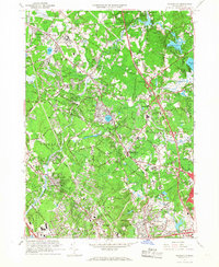
1965 Map of Wilmington
USGS Topo · Published 1968About this map
The Shawsheen River and Lubber Brook wind through this mid-1960s survey of the Massachusetts interior, where suburban expansion meets long-standing institutional and transport corridors. The sprawling complex of the Tewksbury State Hospital dominates the northwest, while the Boston and Maine RR corridors define the industrial and residential growth patterns of Wilmington and North Wilmington. Genealogists will find numerous local landmarks including Tewksbury Cem, State Hospital Cem, and Wildwood Cemetery, alongside various local schools like the Heath Brook Sch.
Find a feature on this map
100 named features on this map. Tap any name to fly to it.
Don’t see what you’re looking for? This feature index may not catch every label — zoom into the map to look around manually.
Map Details
Editions of this 1965 Wilmington Map
2 editions found
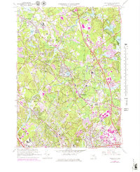
Other maps of this area

1886 · Lawrence
USGS Topo · 1:62,500

1886 · Lowell
USGS Topo · 1:62,500

1886 · Framingham
USGS Topo · 1:62,500

1888 · Lawrence
USGS Topo · 1:62,500

1889 · Framingham
USGS Topo · 1:62,500

1893 · Lowell
USGS Topo · 1:62,500

1893 · Boston
USGS Topo · 1:62,500

1893 · Lawrence
USGS Topo · 1:62,500

1894 · Framingham
USGS Topo · 1:62,500

1903 · Boston
USGS Topo · 1:62,500