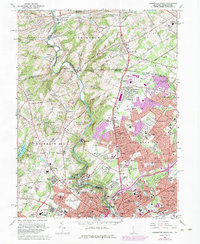
1967 Map of Wilmington North
USGS Topo · Published 1984About this map
Brandywine Creek carves a central path through this landscape, serving as a historic corridor of industry and estate culture as Wilmington expanded northward into the Brandywine Valley. The transition from industrial heritage to suburban development is evident in the presence of the Hagley Museum and the sprawling Winterthur Museum and Gardens alongside the emerging neighborhoods of Fairfax and McDaniel Heights. Cultural and institutional anchors like the Wilmington Country Club and the Brandywine Raceway reflect the mid-century leisure economy, while the northern reaches maintain a more rural character near Chadds Ford and Brandywine Summit. Significant transportation infrastructure, including the Penn Central rail lines and Governor Printz Blvd, ties these burgeoning residential districts to the urban core of Wilmington, which is visible at the southern edge of the sheet.
Find a feature on this map
140 named features on this map. Tap any name to fly to it.
Don’t see what you’re looking for? This feature index may not catch every label — zoom into the map to look around manually.
Map Details
Editions of this 1967 Wilmington North Map
4 editions found
Other maps of this area

1890 · Salem
USGS Topo · 1:62,500

1894 · Chester
USGS Topo · 1:62,500

1896 · Chester
USGS Topo · 1:62,500

1898 · Salem
USGS Topo · 1:62,500

1898 · Chester
USGS Topo · 1:62,500

1901 · Camden
USGS Topo · 1:125,000

1901 · West Chester
USGS Topo · 1:62,500

1904 · West Chester
USGS Topo · 1:62,500

1904 · Wilmington
USGS Topo · 1:62,500

1906 · Wilmington
USGS Topo · 1:62,500