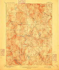
1889 Map of Wilmington
USGS Topo · Published 1910About this map
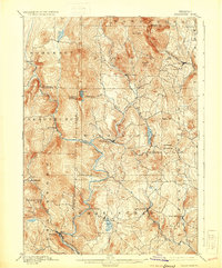
Wilmington sits at the hub of this late nineteenth-century portrait of southern Vermont, where the Deerfield River and its North Branch converge. The landscape is defined by the steep elevation of the Green Mountains, featuring prominent peaks like Hogback Mountain and Haystack Mountain. In the south, the industrial and transport needs of the era are visible through the path of the Hoosac Tunnel and Wilmington R. R., which follows the river valley through Readsboro. Small hamlets and villages such as Jacksonville, Whitingham, and West Halifax are connected by a network of early roads, showing a settled but difficult terrain. Water bodies like Sadawga Pond and Ray Pond break the heavy contour lines of the highlands, providing essential resources for the dispersed settlements of Windham County at the close of the century.
Find a feature on this map
49 named features on this map. Tap any name to fly to it.
Don’t see what you’re looking for? This feature index may not catch every label — zoom into the map to look around manually.
Map Details
Editions of this 1889 Wilmington Map
7 editions found
Other maps of this area

1886 · Greylock
USGS Topo · 1:62,500

1886 · Hawley
USGS Topo · 1:62,500

1889 · Wilmington
USGS Topo · 1:62,500

1890 · Hawley
USGS Topo · 1:62,500

1890 · Greenfield
USGS Topo · 1:62,500

1891 · Wilmington
USGS Topo · 1:62,500

1891 · Greylock
USGS Topo · 1:62,500

1891 · Brattleboro
USGS Topo · 1:62,500

1893 · Brattleboro
USGS Topo · 1:62,500

1893 · Greylock
USGS Topo · 1:62,500