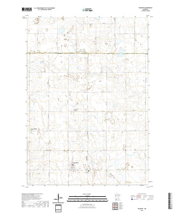
2022 Map of Wilmont
USGS Topo · Published 2022About this map
Wilmont and Saint Kilian anchor this agricultural landscape in Nobles County, situated along the distinctive geological rise of the Coteau des Prairies. The township is defined by a rigorous grid of section lines and rural roads, including State Hwy 266 and Co Rd 15, which connect isolated farmsteads and rural properties. Local history is centered at the Wilmont Calvary Cem south of the main town site, while the drainage of the upland prairie is traced by watercourses like Jack Cr and Willow Lake near the Murray County line. The map illustrates the enduring spatial organization of southwestern Minnesota's prairie land, where the township and range system dictated the development of small settlements and transportation corridors that remain largely unchanged in their layout into the twenty-first century.
Find a feature on this map
42 named features on this map. Tap any name to fly to it.
Don’t see what you’re looking for? This feature index may not catch every label — zoom into the map to look around manually.
Map Details
Editions of this 2022 Wilmont Map
This is the sole edition of this map. No revisions or reprints were ever made.
Other maps of this area

1954 · Fairmont
USGS Topo · 1:250,000

1958 · Fairmont
USGS Topo · 1:250,000

1960 · Reading
USGS Topo · 1:24,000

1967 · Slayton SW
USGS Topo · 1:24,000

1967 · Slayton
USGS Topo · 1:24,000

1967 · Wilmont
USGS Topo · 1:24,000

1967 · Adrian NE
USGS Topo · 1:24,000

1967 · Adrian
USGS Topo · 1:24,000
1967 · Chandler
USGS Topo · 1:24,000
1970 · Fulda SW
USGS Topo · 1:24,000