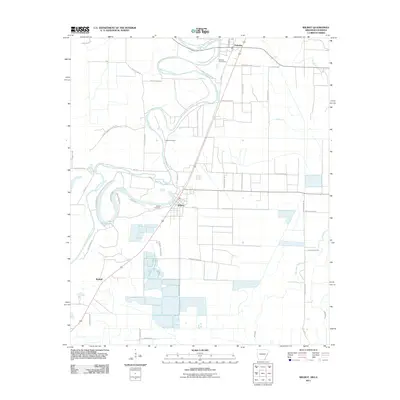
2011 Map of Wilmot
USGS Topo · Published 2011About this map
Bayou Bartholomew snakes through the landscape, defining the agricultural character of this region near the Arkansas-Louisiana border. The town of Wilmot serves as a central hub, situated along the waterway and a primary rail corridor, with Kimball and Parkdale anchoring the northern and southern reaches of the quadrangle. The map reveals a land heavily utilized for aquaculture and agriculture, notably marked by industrial-scale operations like the Mainline Fish Farm RD and Devampert Farm RD.
Find a feature on this map
42 named features on this map. Tap any name to fly to it.
Don’t see what you’re looking for? This feature index may not catch every label — zoom into the map to look around manually.
Map Details
Editions of this 2011 Wilmot Map
This is the sole edition of this map. No revisions or reprints were ever made.
Other maps of this area

1935 · Wilmot
USGS Topo · 1:62,500

1935 · Oak Grove
USGS Topo · 1:62,500

1935 · Bonita
USGS Topo · 1:62,500

1936 · Eudora
USGS Topo · 1:62,500

1953 · Greenwood
USGS Topo · 1:250,000

1955 · Jackson
USGS Topo · 1:250,000

1956 · Greenwood
USGS Topo · 1:250,000

1957 · Eudora
USGS Topo · 1:62,500

1958 · Oak Grove
USGS Topo · 1:62,500

1958 · Bonita
USGS Topo · 1:62,500