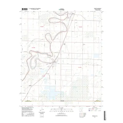
2017 Map of Wilmot
USGS Topo · Published 2017About this map
Bayou Bartholomew meanders through this portion of Southeast Arkansas, creating a landscape of tight oxbows and wetlands near the Louisiana border. The settlement of Wilmot serves as a central hub, where residential streets like Cemetery St and Keller Ave meet the rural road network. To the north, the community of Parkdale is situated near the Parkdale Cemeteries and the winding course of the bayou. The area is characterized by agricultural development, with Mainline Farm Rd and Mainline Fish Farm Rd suggesting the local aquaculture and farming industry. Scattered across the plains are several family and community burial grounds, including Smith Cem and Wonner Grove Cem. Other geographic features include Lake Enterprise, Glover Brake, and Dry Bayou, illustrating the complex hydrology of the Mississippi Delta region.
Find a feature on this map
54 named features on this map. Tap any name to fly to it.
Don’t see what you’re looking for? This feature index may not catch every label — zoom into the map to look around manually.
Map Details
Editions of this 2017 Wilmot Map
This is the sole edition of this map. No revisions or reprints were ever made.
Other maps of this area

1935 · Wilmot
USGS Topo · 1:62,500

1935 · Oak Grove
USGS Topo · 1:62,500

1935 · Bonita
USGS Topo · 1:62,500

1936 · Eudora
USGS Topo · 1:62,500

1953 · Greenwood
USGS Topo · 1:250,000

1955 · Jackson
USGS Topo · 1:250,000

1956 · Greenwood
USGS Topo · 1:250,000

1957 · Eudora
USGS Topo · 1:62,500

1958 · Oak Grove
USGS Topo · 1:62,500

1958 · Bonita
USGS Topo · 1:62,500