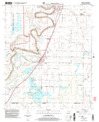
2002 Map of Wilmot
USGS Topo · Published 2003About this map
The winding course of Bayou Bartholomew anchors this landscape along the state line where Arkansas meets Louisiana. The settlement of Wilmot is positioned near the prominent curve of Lake Enterprise, while Parkdale sits to the north. This survey documents a rural community defined by its spiritual and educational centers, including Sweet Home Ch, Gospel Temple, and Savage High Sch.
Find a feature on this map
29 named features on this map. Tap any name to fly to it.
Don’t see what you’re looking for? This feature index may not catch every label — zoom into the map to look around manually.
Map Details
Editions of this 2002 Wilmot Map
This is the sole edition of this map. No revisions or reprints were ever made.
Other maps of this area

1935 · Wilmot
USGS Topo · 1:62,500

1935 · Oak Grove
USGS Topo · 1:62,500

1935 · Bonita
USGS Topo · 1:62,500

1936 · Eudora
USGS Topo · 1:62,500

1953 · Greenwood
USGS Topo · 1:250,000

1955 · Jackson
USGS Topo · 1:250,000

1956 · Greenwood
USGS Topo · 1:250,000

1957 · Eudora
USGS Topo · 1:62,500

1958 · Oak Grove
USGS Topo · 1:62,500

1958 · Bonita
USGS Topo · 1:62,500