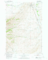
1951 Map of Wilsall
USGS Topo · Published 1975About this map
The settlement of Wilsall serves as the focal point of this 1951 study, situated where the Shields River valley meets the rising slopes of Battle Ridge. The landscape is defined by the Northern Pacific railroad line, which runs parallel to the river and established the area's primary transportation corridor during the mid-century. Rural education and community life are grounded by landmarks such as the Meyersburg Sch to the northwest and the Brackett Creek School in the southern reaches, reflecting a dispersed agricultural population supported by numerous water sources like Flathead Creek and Looking Glass Creek. The presence of the Wilsall Cemetery and various local roads highlights the infrastructure of this Montana community before later 20th-century developments, preserving a record of the homesteads and small-scale ranching operations that shaped the Shields Valley.
Find a feature on this map
15 named features on this map. Tap any name to fly to it.
Don’t see what you’re looking for? This feature index may not catch every label — zoom into the map to look around manually.
Map Details
Editions of this 1951 Wilsall Map
3 editions found
Other maps of this area

1886 · Little Belt Mts.
USGS Topo · 1:250,000

1891 · Livingston
USGS Topo · 1:250,000

1893 · Livingston
USGS Topo · 1:250,000

1894 · Little Belt Mts.
USGS Topo · 1:250,000

1897 · Little Belt Mts.
USGS Topo · 1:250,000

1898 · Little Belt Mts.
USGS Topo · 1:250,000

1902 · Little Belt Mts.
USGS Topo · 1:250,000

1947 · Bozeman
USGS Topo · 1:250,000

1948 · Bozeman
USGS Topo · 1:250,000

1948 · White Sulphur Springs
USGS Topo · 1:250,000