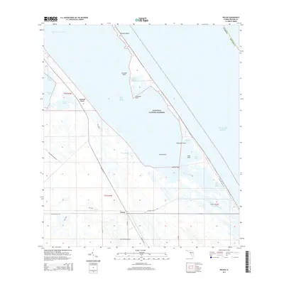
2015 Map of Wilson
USGS Topo · Published 2015About this map
Canaveral National Seashore dominates this coastal landscape, where the Atlantic barrier island system meets the complex wetlands of Brevard County. The map documents a unique intersection of aerospace infrastructure and protected natural wilderness, centered on the historic Wilson and Dummit Grove locales. Within this sensitive corridor, the NASA Landing Facility sits just west of the Indian River Lagoon, illustrating the region's mid-century transformation from a remote coastal stretch into a critical hub for American space exploration.
Find a feature on this map
30 named features on this map. Tap any name to fly to it.
Don’t see what you’re looking for? This feature index may not catch every label — zoom into the map to look around manually.
Map Details
Editions of this 2015 Wilson Map
This is the sole edition of this map. No revisions or reprints were ever made.
Other maps of this area

1949 · Oak Hill
USGS Topo · 1:24,000

1949 · Pardon Island
USGS Topo · 1:24,000

1949 · Orsino
USGS Topo · 1:24,000

1949 · False Cape
USGS Topo · 1:24,000

1949 · Titusville
USGS Topo · 1:24,000

1949 · Wilson
USGS Topo · 1:24,000

1949 · Mims
USGS Topo · 1:24,000

1951 · False Cape
USGS Topo · 1:24,000

1951 · Orsino
USGS Topo · 1:24,000

1952 · Mims
USGS Topo · 1:24,000