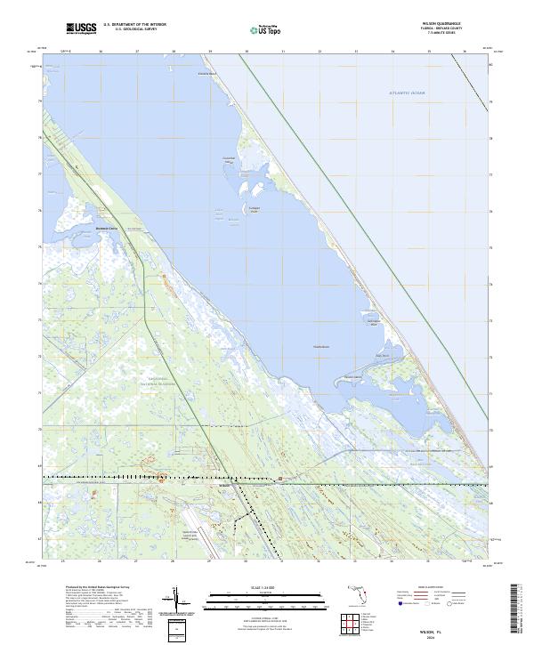
2024 Map of Wilson
USGS Topo · Published 2024About this map
The barrier islands and lagoons of Brevard County are meticulously documented in this contemporary survey, where the historic settlement of Wilson sits at a critical junction of modern conservation and aerospace history. Much of the landscape is preserved within the Merritt Island National Wildlife Refuge and Canaveral National Seashore, protecting features like Klondike Beach and the intricate waters of the Indian River Lagoon and Mosquito Lagoon. The map highlights the transformation of the region, showing the Space Florida Launch and Landing Facility adjacent to traditional landmarks like Dummit Grove. Waterways such as Dummit Creek, Cucumber Slough, and the Intracoastal Waterway thread through the marshes, while named points like Turtlepen Point and Gallinipper Point define the shifting shoreline of the Middle Banks. Transportation is represented by the Kennedy Parkway and the Max Brewer Memorial Pkwy, which provide access to this sensitive coastal ecosystem.
Find a feature on this map
41 named features on this map. Tap any name to fly to it.
Don’t see what you’re looking for? This feature index may not catch every label — zoom into the map to look around manually.
Map Details
Editions of this 2024 Wilson Map
This is the sole edition of this map. No revisions or reprints were ever made.
Other maps of this area

1949 · Oak Hill
USGS Topo · 1:24,000

1949 · Pardon Island
USGS Topo · 1:24,000

1949 · Orsino
USGS Topo · 1:24,000

1949 · False Cape
USGS Topo · 1:24,000

1949 · Titusville
USGS Topo · 1:24,000

1949 · Wilson
USGS Topo · 1:24,000

1949 · Mims
USGS Topo · 1:24,000

1951 · False Cape
USGS Topo · 1:24,000

1951 · Orsino
USGS Topo · 1:24,000

1952 · Mims
USGS Topo · 1:24,000