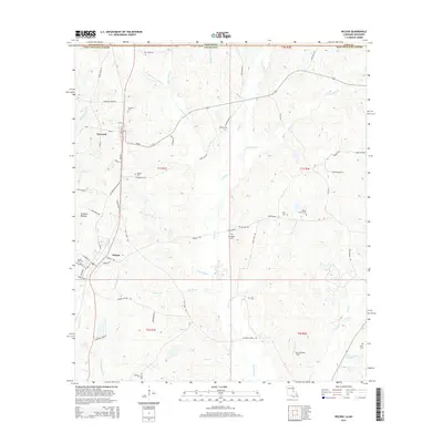
2015 Map of Wilson
USGS Topo · Published 2015About this map
Norwood serves as the primary residential anchor in this portion of East Feliciana Parish, where a network of local roads such as Azalea and Pine Rd connect small-scale settlements to the surrounding timber and agricultural lands. The terrain is deeply defined by a complex drainage system, where Kellers Bayou and Comite Cr wind through the landscape toward the Comite River. This map is particularly valuable for genealogical research, documenting numerous small family and community burial grounds including Norwood Cem, Dubose Cem, and the Easter Star Cem. The presence of Springhill Ch and scattered landmarks like Mc Cutcheon Field reflect the rural social fabric of the region near the Mississippi border, where the land remains divided by the historic Public Land Survey System grids of t1s r1e and t2s r2e.
Find a feature on this map
74 named features on this map. Tap any name to fly to it.
Don’t see what you’re looking for? This feature index may not catch every label — zoom into the map to look around manually.
Map Details
Editions of this 2015 Wilson Map
This is the sole edition of this map. No revisions or reprints were ever made.
Other maps of this area

1906 · Bayou Sara
USGS Topo · 1:125,000

1941 · Woodland
USGS Topo · 1:31,680

1941 · Norwood
USGS Topo · 1:31,680

1941 · Lost Creek
USGS Topo · 1:31,680

1945 · Norwood
USGS Topo · 1:31,680

1945 · Jackson
USGS Topo · 1:31,680

1945 · Lost Creek
USGS Topo · 1:31,680

1946 · Clinton
USGS Topo · 1:31,680

1949 · Bluff Creek
USGS Topo · 1:31,680

1953 · Natchez
USGS Topo · 1:250,000