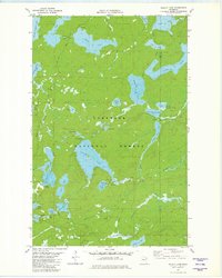
1981 Map of Wilson Lake
USGS Topo · Published 1982About this map
The Superior National Forest dominates this northern landscape, which is defined by a complex network of glacial lakes and historical transport corridors. The map records the remnants of the region's logging and mining history, notably an Old RR Grade and Old Railroad Grade that cross the southern portion of the quadrangle. These routes suggest an era of industrial extraction that predates the modern recreational focus of the forest. Large water bodies like Silver Island Lake, Wilson Lake, and Elbow Lake are connected by smaller streams such as Windy Cr and the Cross River. Small infrastructure details, including several Gravel Pit locations and Public Access points at Little Wilson Lake and Harriet Lake, reflect the transition of this area into a managed wilderness and resource zone as the twentieth century progressed.
Find a feature on this map
44 named features on this map. Tap any name to fly to it.
Don’t see what you’re looking for? This feature index may not catch every label — zoom into the map to look around manually.
Map Details
Editions of this 1981 Wilson Lake Map
2 editions found
Other maps of this area

1954 · Two Harbors
USGS Topo · 1:250,000

1955 · Schroeder
USGS Topo · 1:24,000

1955 · Tofte
USGS Topo · 1:62,500

1955 · Cramer
USGS Topo · 1:62,500

1957 · Two Harbors
USGS Topo · 1:250,000

1958 · Two Harbors
USGS Topo · 1:250,000

1960 · Kawishiwi Lake
USGS Topo · 1:24,000

1960 · Perent Lake
USGS Topo · 1:24,000

1960 · Beth Lake
USGS Topo · 1:24,000

1964 · Two Harbors
USGS Topo · 1:250,000