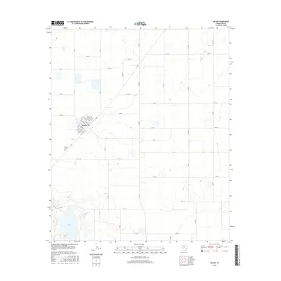
2016 Map of Wilson
USGS Topo · Published 2016About this map
Wilson serves as the primary hub of this high plains agricultural landscape in Lynn County. The town is laid out on a precise grid with street names like Green St, 10th St, and 14th St centering the community. Outside the town limits, the terrain is defined by a dense network of county roads, including Co Rd X and Co Rd AA, which segment the land into large, productive parcels. In the southwestern corner, the environment shifts toward significant natural depressions. Here, Tahoka Lake and the smaller Hidden Lake provide distinct geographic contrast to the surrounding tableland. State transit is facilitated by Fm 400 and Fm 211, while Green Memorial Park stands as a notable landmark just south of the main settlement.
Find a feature on this map
43 named features on this map. Tap any name to fly to it.
Don’t see what you’re looking for? This feature index may not catch every label — zoom into the map to look around manually.
Map Details
Editions of this 2016 Wilson Map
This is the sole edition of this map. No revisions or reprints were ever made.
Other maps of this area

1954 · Lubbock
USGS Topo · 1:250,000

1957 · New Home
USGS Topo · 1:62,500

1965 · Slaton
USGS Topo · 1:24,000

1965 · Southland
USGS Topo · 1:24,000

1965 · Wilson
USGS Topo · 1:24,000

1965 · Slaton NE
USGS Topo · 1:24,000

1969 · Tahoka
USGS Topo · 1:24,000

1970 · New Lynn
USGS Topo · 1:24,000

1970 · Grassland
USGS Topo · 1:24,000

1976 · New Home NE
USGS Topo · 1:24,000