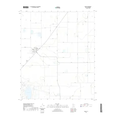
2019 Map of Wilson
USGS Topo · Published 2019About this map
Wilson occupies the western edge of this Lynn County landscape, its grid of residential streets including Culpepper Ave, Lumsden Ave, and Gouger Ave organized around the central axis of Green St. The town sits at the intersection of FM 400 and FM 211, surrounded by a vast network of numbered county roads that define the region's agricultural layout. South of the town center, Green Memorial Park provides a dedicated community landmark. The terrain to the southwest drops into a series of depressions where Tahoka Lake and Hidden Lake gather, forming distinct topographical breaks in the otherwise uniform High Plains survey grid. These natural catchments serve as the primary landmarks in an area dominated by systematic land division and rural infrastructure.
Find a feature on this map
39 named features on this map. Tap any name to fly to it.
Don’t see what you’re looking for? This feature index may not catch every label — zoom into the map to look around manually.
Map Details
Editions of this 2019 Wilson Map
This is the sole edition of this map. No revisions or reprints were ever made.
Other maps of this area

1954 · Lubbock
USGS Topo · 1:250,000

1957 · New Home
USGS Topo · 1:62,500

1965 · Slaton
USGS Topo · 1:24,000

1965 · Southland
USGS Topo · 1:24,000

1965 · Wilson
USGS Topo · 1:24,000

1965 · Slaton NE
USGS Topo · 1:24,000

1969 · Tahoka
USGS Topo · 1:24,000

1970 · New Lynn
USGS Topo · 1:24,000

1970 · Grassland
USGS Topo · 1:24,000

1976 · New Home NE
USGS Topo · 1:24,000