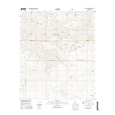
2013 Map of Wilson Mountain
USGS Topo · Published 2013About this map
The San Francisco River cuts a deep path through the high desert of the Gila National Forest on this 2013 survey of the New Mexico interior. This terrain is defined by a complex network of canyons and high-elevation peaks, including Wilson Mtn and the striking Sierra Aguilada range. Of particular interest are the geothermal features along the river corridor, specifically the San Francisco Hot Springs and Frisco Hot Springs, which mark the geologic activity of the region.
Find a feature on this map
75 named features on this map. Tap any name to fly to it.
Don’t see what you’re looking for? This feature index may not catch every label — zoom into the map to look around manually.
Map Details
Editions of this 2013 Wilson Mountain Map
This is the sole edition of this map. No revisions or reprints were ever made.
Other maps of this area

1910 · Mogollon
USGS Topo · 1:125,000

1912 · Mogollon
USGS Topo · 1:125,000

1913 · Morenci
USGS Topo · 1:125,000

1915 · Morenci
USGS Topo · 1:125,000

1954 · Clifton
USGS Topo · 1:250,000

1957 · Clifton
USGS Topo · 1:250,000

1958 · Clifton
USGS Topo · 1:250,000

1962 · Clifton
USGS Topo · 1:250,000

1962 · Big Lue Mts
USGS Topo · 1:62,500
1965 · Mule Creek
USGS Topo · 1:24,000