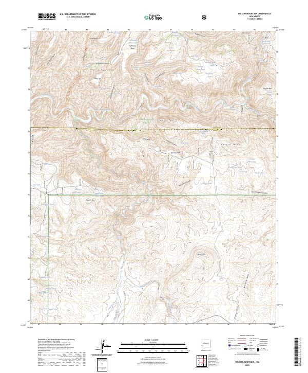
2023 Map of Wilson Mountain
USGS Topo · Published 2023About this map
Gila National Forest encompasses this wilderness landscape along the border of Grant and Catron counties, where the San Francisco River cuts through deeply incised terrain. The area is defined by its thermal features and water management, notably the San Francisco Hot Springs and Frisco Hot Springs situated near the river's bend. A complex network of livestock tanks and springs, such as Lightning Mesa Tank and Gorilla Spring, supports the high-desert environment. Geologic landmarks and evocative place names suggest a history of early range use and frontier movement, from the high peaks of Wilson Mtn and Snow Peak to the hidden reaches of Angel Roost and Outlaw Mtn. Evidence of historic transit remains visible along the Goat Corral Trl, which winds through the Sierra Aguilada range toward the river valley.
Find a feature on this map
76 named features on this map. Tap any name to fly to it.
Don’t see what you’re looking for? This feature index may not catch every label — zoom into the map to look around manually.
Map Details
Editions of this 2023 Wilson Mountain Map
This is the sole edition of this map. No revisions or reprints were ever made.
Other maps of this area

1910 · Mogollon
USGS Topo · 1:125,000

1912 · Mogollon
USGS Topo · 1:125,000

1913 · Morenci
USGS Topo · 1:125,000

1915 · Morenci
USGS Topo · 1:125,000

1954 · Clifton
USGS Topo · 1:250,000

1957 · Clifton
USGS Topo · 1:250,000

1958 · Clifton
USGS Topo · 1:250,000

1962 · Clifton
USGS Topo · 1:250,000

1962 · Big Lue Mts
USGS Topo · 1:62,500
1965 · Mule Creek
USGS Topo · 1:24,000