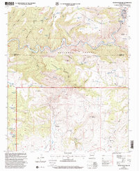
1999 Map of Wilson Mountain
USGS Topo · Published 2002About this map
San Francisco River meanders through a labyrinth of high-elevation terrain where the Catron and Grant County line bisects the heart of the Gila National Forest. This 1990s revision of earlier 1960s surveys reveals a landscape defined by its water management and livestock history, marked by numerous named tanks such as West Masonry Tank and Upper Drift Fence Tank. The area is characterized by significant topographic shifts, from the depths of Goat Basin and Ringtail Canyon to the heights of Wilson Mountain and Outlaw Mountain.
Find a feature on this map
78 named features on this map. Tap any name to fly to it.
Don’t see what you’re looking for? This feature index may not catch every label — zoom into the map to look around manually.
Map Details
Editions of this 1999 Wilson Mountain Map
This is the sole edition of this map. No revisions or reprints were ever made.
Other maps of this area

1910 · Mogollon
USGS Topo · 1:125,000

1912 · Mogollon
USGS Topo · 1:125,000

1913 · Morenci
USGS Topo · 1:125,000

1915 · Morenci
USGS Topo · 1:125,000

1954 · Clifton
USGS Topo · 1:250,000

1957 · Clifton
USGS Topo · 1:250,000

1958 · Clifton
USGS Topo · 1:250,000

1962 · Clifton
USGS Topo · 1:250,000

1962 · Big Lue Mts
USGS Topo · 1:62,500
1965 · Mule Creek
USGS Topo · 1:24,000