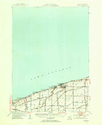
1948 Map of Wilson
USGS Topo · Published 1956About this map
Lake Ontario borders the northern edge of this Niagara County landscape, where the village of Wilson serves as the primary hub of activity. The shoreline is characterized by a series of residential summer clusters and lakefront landings, including Roosevelt Beach, Uneeda Beach, and Harrison Grove. Moving inland, the map captures a rural economy defined by a grid of local thoroughfares like Lake Road and Youngstown Road, which connect scattered agricultural hamlets such as Elberta and Pleasant Corners.
Find a feature on this map
31 named features on this map. Tap any name to fly to it.
Don’t see what you’re looking for? This feature index may not catch every label — zoom into the map to look around manually.
Map Details
Editions of this 1948 Wilson Map
2 editions found
Other maps of this area

1894 · Niagara Falls
USGS Topo · 1:62,500

1894 · Wilson
USGS Topo · 1:62,500

1896 · Niagara Falls
USGS Topo · 1:62,500

1897 · Tonawanda
USGS Topo · 1:62,500

1897 · Olcott
USGS Topo · 1:62,500

1897 · Lockport
USGS Topo · 1:62,500

1899 · Niagara
USGS Topo · 1:125,000

1900 · Wilson
USGS Topo · 1:62,500

1900 · Tonawanda
USGS Topo · 1:62,500

1900 · Niagara Falls
USGS Topo · 1:62,500