
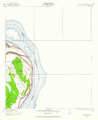
1909 Map of Wilsons Point
USGS Topo · Published 1909About this map
Mississippi River alluvial lands dominate this 1909 survey of East Carroll Parish, showing a landscape defined by the shifting course of the water and the protective levees that governed life along the bank. The map centers on the community of Wilsons Point, situated on a prominent bend where the Louisiana Mississippi Boundary Line follows the mid-channel flow. A distinctive landform, Wilson Point, is tucked within the river's curve, flanked by the horseshoe-shaped Wilsons Point Lake, which likely marks an older meander cutoff.
Find a feature on this map
7 named features on this map. Tap any name to fly to it.
Don’t see what you’re looking for? This feature index may not catch every label — zoom into the map to look around manually.
Map Details
Editions of this 1909 Wilsons Point Map
2 editions found
Other maps of this area

1909 · Lake Providence
USGS Topo · 1:24,000

1909 · Millikin
USGS Topo · 1:24,000

1911 · Lake Providence
USGS Topo · 1:31,680

1913 · Wilson Point
USGS Topo · 1:31,680

1939 · Lorenzen
USGS Topo · 1:62,500

1939 · Readland
USGS Topo · 1:62,500

1939 · Mayersville
USGS Topo · 1:62,500

1939 · Swan Lake
USGS Topo · 1:62,500

1953 · Greenwood
USGS Topo · 1:250,000

1955 · Jackson
USGS Topo · 1:250,000