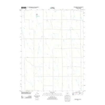
2011 Map of Wilsonville NE
USGS Topo · Published 2011About this map
Timmons Creek carves a path through this agricultural section of Furnas County, highlighting a landscape defined by a structured grid of rural transport and water management. This area is characterized by its systematic section lines, where Road 418, Road 718, and Road 719 provide the primary infrastructure for the local farming community. The topography is shaped by the presence of the Johnson Detention Dam 3 and Johnson Reservoir 3, which serve as vital components for local water retention and drainage in this High Plains environment. The map details a network of secondary routes like Road 413 and Road 716, illustrating the precise organization of Nebraska's rural land divisions during the early 21st century.
Find a feature on this map
18 named features on this map. Tap any name to fly to it.
Don’t see what you’re looking for? This feature index may not catch every label — zoom into the map to look around manually.
Map Details
Editions of this 2011 Wilsonville NE Map
This is the sole edition of this map. No revisions or reprints were ever made.
Other maps of this area

1896 · Arapahoe
USGS Topo · 1:125,000

1898 · Arapahoe
USGS Topo · 1:125,000

1954 · McCook
USGS Topo · 1:250,000

1955 · Grand Island
USGS Topo · 1:250,000

1956 · Cambridge
USGS Topo · 1:24,000

1957 · McCook
USGS Topo · 1:250,000

1957 · Grand Island
USGS Topo · 1:250,000
1957 · Beaver City SW
USGS Topo · 1:24,000

1957 · Shippee
USGS Topo · 1:24,000
1957 · Wilsonville
USGS Topo · 1:24,000