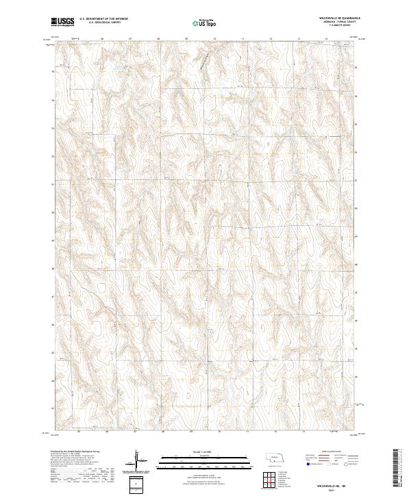
2021 Map of Wilsonville NE
USGS Topo · Published 2021About this map
Wild Horse Canyon and the winding course of Timmons Cr define the dissected topography of this rural Furnas County landscape. This 2021 survey illustrates a strictly organized agricultural grid, where the Public Land Survey System township lines for t3n r25w, t3n r24w, t2n r25w, and t2n r24w dictate the movement of local traffic across a network of gravel roads. Human modification of the drainage patterns is most visible at Johnson Reservoir 3 in the northwestern portion of the sheet. While the area is dominated by open terrain and creek beds, the precision of the modern road numbering system, including RD 718, RD 714, and RD 716, provides a clear framework for locating specific farmsteads and rural family tracts.
Find a feature on this map
24 named features on this map. Tap any name to fly to it.
Don’t see what you’re looking for? This feature index may not catch every label — zoom into the map to look around manually.
Map Details
Editions of this 2021 Wilsonville NE Map
This is the sole edition of this map. No revisions or reprints were ever made.
Other maps of this area

1896 · Arapahoe
USGS Topo · 1:125,000

1898 · Arapahoe
USGS Topo · 1:125,000

1954 · McCook
USGS Topo · 1:250,000

1955 · Grand Island
USGS Topo · 1:250,000

1956 · Cambridge
USGS Topo · 1:24,000

1957 · McCook
USGS Topo · 1:250,000

1957 · Grand Island
USGS Topo · 1:250,000
1957 · Beaver City SW
USGS Topo · 1:24,000

1957 · Shippee
USGS Topo · 1:24,000
1957 · Wilsonville
USGS Topo · 1:24,000