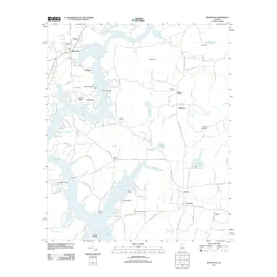
2011 Map of Wilsonville
USGS Topo · Published 2011About this map
Lay Lake dominates the central landscape of this Alabama quadrangle, its sprawling backwaters defining the social and economic geography of the river valley. The town of Wilsonville sits at the northern edge, marked by the Wilsonville Post Office and Wilsonville Cemetery, while the small settlement of Fayetteville anchors the southeastern corner. The map reveals a shoreline lined with recreation and seasonal residences, such as Shelby Shores, Carleton Point, and Indian Shoals. Historic family and community sites are well-preserved in the record, including the Fort Williams Cemetery near the lake's edge and the inland Kahatchee Cemetery. Notable water control and access points like Goodner Dam, Cleitts Dam, and Perkins Ferry illustrate how the community has historically interacted with the Coosa River system. From the heights of Katala Hills to the residential clusters at Campbells Crossroads, the map provides a clear picture of twentieth-century rural development and lakeside life.
Find a feature on this map
124 named features on this map. Tap any name to fly to it.
Don’t see what you’re looking for? This feature index may not catch every label — zoom into the map to look around manually.
Map Details
Editions of this 2011 Wilsonville Map
This is the sole edition of this map. No revisions or reprints were ever made.
Other maps of this area

1890 · Bessemer
USGS Topo · 1:125,000

1890 · Talladega
USGS Topo · 1:125,000

1892 · Talladega
USGS Topo · 1:125,000

1892 · Bessemer
USGS Topo · 1:125,000

1906 · Vandiver
USGS Topo · 1:62,500

1908 · Vandiver
USGS Topo · 1:62,500

1909 · Columbiana
USGS Topo · 1:62,500

1911 · Columbiana
USGS Topo · 1:62,500

1915 · Gantts Quarry
USGS Topo · 1:48,000

1917 · Gantts Quarry
USGS Topo · 1:62,500