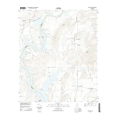
2014 Map of Wilsonville
USGS Topo · Published 2014About this map
Wilsonville serves as a northern anchor where the Coosa River bends through the borderlands of Shelby and Talladega counties. This 2014 landscape is defined by the winding waters of Lay Lake, which creates a complex shoreline of inlets and points like Bullocks Islands. Settlement patterns follow the river and local ridge lines, with smaller communities such as Shelby Shores, Kahatchee, and Fayetteville scattered across the undulating terrain. Genealogists will find significant value in the distribution of family-named burial sites, including Wilsonville Cem, Kahatchee Cem, Heaslet Cem, and the riverfront Ft Williams Cem. The map also captures local natural landmarks like Chalybeate Spring and the elevations of the Katala Hills and Cohabie Mtn, illustrating the varied topography of central Alabama just east of the river's main channel.
Find a feature on this map
110 named features on this map. Tap any name to fly to it.
Don’t see what you’re looking for? This feature index may not catch every label — zoom into the map to look around manually.
Map Details
Editions of this 2014 Wilsonville Map
This is the sole edition of this map. No revisions or reprints were ever made.
Other maps of this area

1890 · Bessemer
USGS Topo · 1:125,000

1890 · Talladega
USGS Topo · 1:125,000

1892 · Talladega
USGS Topo · 1:125,000

1892 · Bessemer
USGS Topo · 1:125,000

1906 · Vandiver
USGS Topo · 1:62,500

1908 · Vandiver
USGS Topo · 1:62,500

1909 · Columbiana
USGS Topo · 1:62,500

1911 · Columbiana
USGS Topo · 1:62,500

1915 · Gantts Quarry
USGS Topo · 1:48,000

1917 · Gantts Quarry
USGS Topo · 1:62,500