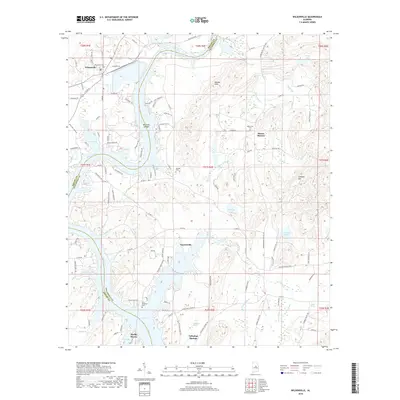
2018 Map of Wilsonville
USGS Topo · Published 2018About this map
Lay Lake and the Coosa River define the winding border between Shelby and Talladega counties in this topographic study. The landscape is dotted with small communities like Wilsonville, Fayetteville, and Talladega Springs, illustrating the settled character of the river valley. Genealogists will find a wealth of local landmarks, including several named burial grounds such as the Wilsonville Cem and the uniquely named Soldiers Graveyard Cem. The terrain rises from the riverbanks to local peaks such as Cohabie Mtn and the Katala Hills, while several springs, including Chalybeate Spring and Deans Spring, indicate the natural water sources that likely influenced early settlement patterns. Transport through the area relies on a network of routes such as the Childersburg Fayette Hwy and Marble Valley Rd, connecting these river-adjacent towns.
Find a feature on this map
117 named features on this map. Tap any name to fly to it.
Don’t see what you’re looking for? This feature index may not catch every label — zoom into the map to look around manually.
Map Details
Editions of this 2018 Wilsonville Map
This is the sole edition of this map. No revisions or reprints were ever made.
Other maps of this area

1890 · Bessemer
USGS Topo · 1:125,000

1890 · Talladega
USGS Topo · 1:125,000

1892 · Talladega
USGS Topo · 1:125,000

1892 · Bessemer
USGS Topo · 1:125,000

1906 · Vandiver
USGS Topo · 1:62,500

1908 · Vandiver
USGS Topo · 1:62,500

1909 · Columbiana
USGS Topo · 1:62,500

1911 · Columbiana
USGS Topo · 1:62,500

1915 · Gantts Quarry
USGS Topo · 1:48,000

1917 · Gantts Quarry
USGS Topo · 1:62,500