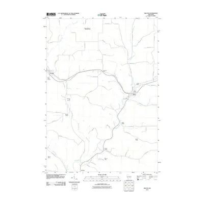
2010 Map of Wilton
USGS Topo · Published 2010About this map
The Kickapoo River meanders through this Monroe County landscape, which is defined by deep valleys such as Dorset Valley, Black Valley, and Kinney Valley. The villages of Wilton and Norwalk serve as the primary population centers, while the small community of Oil City sits at the southern edge. A significant historical and recreational corridor follows the former rail grade, now the Elroy Sparta State Trl, which includes the notable Number Two Tunnel between the two main towns.
Find a feature on this map
59 named features on this map. Tap any name to fly to it.
Don’t see what you’re looking for? This feature index may not catch every label — zoom into the map to look around manually.
Map Details
Editions of this 2010 Wilton Map
This is the sole edition of this map. No revisions or reprints were ever made.
Other maps of this area

1916 · Tomah
USGS Topo · 1:62,500

1919 · Kendall
USGS Topo · 1:62,500

1921 · Kendall
USGS Topo · 1:62,500

1926 · La Farge
USGS Topo · 1:62,500

1927 · Hillsboro
USGS Topo · 1:62,500

1949 · Tomah
USGS Topo · 1:62,500

1958 · La Crosse
USGS Topo · 1:250,000

1961 · La Crosse
USGS Topo · 1:250,000

1962 · Kendall
USGS Topo · 1:62,500

1965 · La Crosse
USGS Topo · 1:250,000