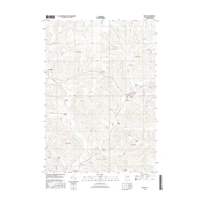
2016 Map of Wilton
USGS Topo · Published 2016About this map
The village of Wilton sits at the junction of several valley systems in Monroe County, where the Kickapoo River begins its winding course southward. This 2016 survey highlights a landscape defined by significant topographic relief, from the lowlands of Dorset Valley to the prominence of Mt Thom and Mt Sally. The infrastructure reflects the challenging terrain of the region, notably marked by the Number Two Tunnel west of Wilton. Historical burial sites are well-documented across the townships, including Hillside Cemetery overlooking the river and Wanderers Rest Cem located further west. Transportation routes like Wilton Rd and Co Hwy T follow the natural contours of the land, connecting smaller settlements like Norwalk and the community of Oil City. The map provides a clear record of rural land divisions across the T16N and T15N townships, illustrating the persistent agricultural and residential patterns of this Wisconsin valley region.
Find a feature on this map
120 named features on this map. Tap any name to fly to it.
Don’t see what you’re looking for? This feature index may not catch every label — zoom into the map to look around manually.
Map Details
Editions of this 2016 Wilton Map
This is the sole edition of this map. No revisions or reprints were ever made.
Other maps of this area

1916 · Tomah
USGS Topo · 1:62,500

1919 · Kendall
USGS Topo · 1:62,500

1921 · Kendall
USGS Topo · 1:62,500

1926 · La Farge
USGS Topo · 1:62,500

1927 · Hillsboro
USGS Topo · 1:62,500

1949 · Tomah
USGS Topo · 1:62,500

1958 · La Crosse
USGS Topo · 1:250,000

1961 · La Crosse
USGS Topo · 1:250,000

1962 · Kendall
USGS Topo · 1:62,500

1965 · La Crosse
USGS Topo · 1:250,000