2022 Map of Wilton
USGS Topo · Published 2022About this map
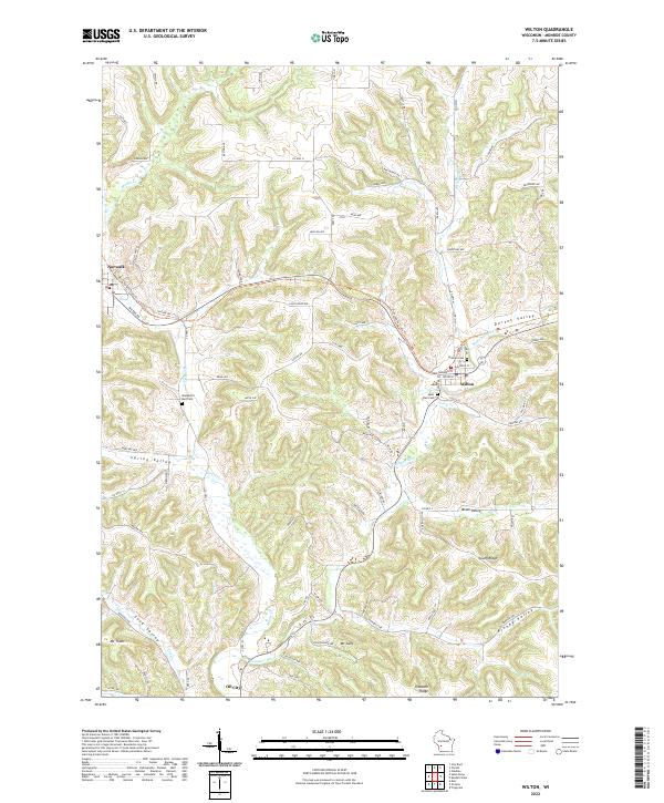
The Kickapoo River flows through a landscape defined by deep valleys and high ridges in this section of Monroe County. The village of Wilton sits at a crossroads where Posey Cr meets the river, while Norwalk serves as a western anchor near the headwaters of Moore Cr. This area is characterized by its agricultural topography, with named landforms like Dorset Valley, Spring Valley, and Kinney Valley separating significant elevations such as Mt Thom and Mt Sally. A notable modern addition to the landscape is the Elroy-Sparta State Trl, which follows a former rail corridor across the northern half of the sheet. Local genealogy and history are preserved at several sites, including Hillside Cem and Saint Paul Cem near Wilton, and the remote Wanderers Rest Cem positioned between the primary settlements. The small community of Oil City appears in the south, marking a quiet junction along the river banks.
Find a feature on this map
84 named features on this map. Tap any name to fly to it.
Don’t see what you’re looking for? This feature index may not catch every label — zoom into the map to look around manually.
Map Details
Editions of this 2022 Wilton Map
This is the sole edition of this map. No revisions or reprints were ever made.