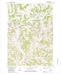
1983 Map of Wilton
USGS Topo · Published 1984About this map
The Kickapoo River flows through the center of this Monroe County landscape, which by the early 1980s was defined by its dramatic ridge-and-valley topography. The village of Wilton sits at the confluence of several valleys, including Dorset Valley and Black Valley, serving as a focal point for local landmarks such as Hillside Cem and St Paul Cem. Further west, the village of Norwalk marks the edge of the survey, while the small settlement of Oil City rests at the southern bend of the river near Brookwood High Sch.
Find a feature on this map
44 named features on this map. Tap any name to fly to it.
Don’t see what you’re looking for? This feature index may not catch every label — zoom into the map to look around manually.
Map Details
Editions of this 1983 Wilton Map
This is the sole edition of this map. No revisions or reprints were ever made.
Other maps of this area

1916 · Tomah
USGS Topo · 1:62,500

1919 · Kendall
USGS Topo · 1:62,500

1921 · Kendall
USGS Topo · 1:62,500

1926 · La Farge
USGS Topo · 1:62,500

1927 · Hillsboro
USGS Topo · 1:62,500

1949 · Tomah
USGS Topo · 1:62,500

1958 · La Crosse
USGS Topo · 1:250,000

1961 · La Crosse
USGS Topo · 1:250,000

1962 · Kendall
USGS Topo · 1:62,500

1965 · La Crosse
USGS Topo · 1:250,000