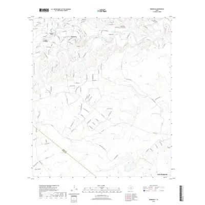
2019 Map of Wimberley
USGS Topo · Published 2019About this map
Wimberley sits at the confluence of Cypress Cr and the Blanco River, serving as the central hub of this Texas Hill Country landscape. The terrain is defined by a series of hollows and passes, including Heaton Hollow, Shelton Hollow, and the distinctive Packsaddle Pass. The map details the transition from established settlements like Pioneer Town and Cloptins Crossing to the newer developments of Flight Acres near the Restoration Ranch Airport. A network of ranch roads and limestone creek beds, such as Spoke Pile Cr and Purgatory Cr, crisscross the area, reflecting the region's complex drainage patterns. The southern portion of the sheet captures the boundary between Hays County and Comal County, illustrating the rural expansion spreading toward the San Marcos vicinity.
Find a feature on this map
117 named features on this map. Tap any name to fly to it.
Don’t see what you’re looking for? This feature index may not catch every label — zoom into the map to look around manually.
Map Details
Editions of this 2019 Wimberley Map
This is the sole edition of this map. No revisions or reprints were ever made.
Other maps of this area

1887 · Blanco
USGS Topo · 1:125,000

1894 · Blanco
USGS Topo · 1:125,000

1896 · Austin
USGS Topo · 1:125,000

1897 · Austin
USGS Topo · 1:125,000

1910 · Austin
USGS Topo · 1:125,000

1911 · San Marcos
USGS Topo · 1:125,000

1919 · San Marcos
USGS Topo · 1:125,000

1925 · Hunter No 3
USGS Topo · 1:48,000

1929 · Hunter
USGS Topo · 1:62,500

1953 · Seguin
USGS Topo · 1:250,000