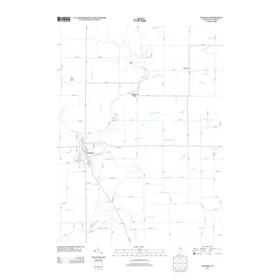
2013 Map of Winamac
USGS Topo · Published 2013About this map
The Tippecanoe River meanders through the heart of Pulaski County, anchoring the town of Winamac at a significant bend in its course. This landscape is defined by an extensive network of drainage infrastructure, such as the Stone Dilts Ditch and Tyler Weisjahn Ditch, which converted former wetlands into productive agricultural territory. The town center is detailed with a grid of streets like W Main St and W Washington St, while the surrounding rural areas are dotted with smaller localities like Bunker Hill and Lawton. To the north, Vanmeter Park sits along the riverbank, and Arens Field Airport serves the region's aviation needs. The map illustrates a complex water management system with features like the Bruce Lake Outlet and Quigley Marsh Ditch feeding into the primary river valley.
Find a feature on this map
75 named features on this map. Tap any name to fly to it.
Don’t see what you’re looking for? This feature index may not catch every label — zoom into the map to look around manually.
Map Details
Editions of this 2013 Winamac Map
This is the sole edition of this map. No revisions or reprints were ever made.
Other maps of this area

1953 · Chicago
USGS Topo · 1:250,000

1953 · Danville
USGS Topo · 1:250,000

1955 · Danville
USGS Topo · 1:250,000

1956 · Danville
USGS Topo · 1:250,000

1957 · Chicago
USGS Topo · 1:250,000

1960 · Grass Creek
USGS Topo · 1:24,000

1962 · Buffalo
USGS Topo · 1:24,000

1962 · Winamac
USGS Topo · 1:24,000

1962 · Star City
USGS Topo · 1:24,000

1962 · Kewanna
USGS Topo · 1:24,000