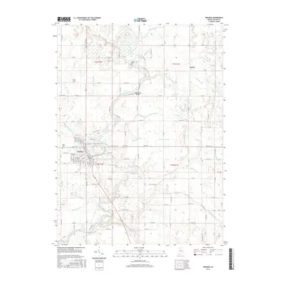
2016 Map of Winamac
USGS Topo · Published 2016About this map
The Tippecanoe River meanders through the heart of Pulaski County, serving as the primary geographic corridor for this region. The settlement of Winamac occupies a significant bend in the river, characterized by its grid of streets and historical burial grounds including Crown Hill Cem and Memorial Gardens. The surrounding landscape is defined by an extensive drainage network, where numerous ditches such as Thompson Ditch and Quigley Marsh Ditch navigate the flatlands between the river and Devil Lake. This complex hydrology highlights the intensive agricultural development of the Indiana plains, where even small elevations like Bunker Hill stand out against the horizon. Smaller locales such as Lawton are visible in the northeastern quadrant, while community spaces like Vanmeter Park and several outlying cemeteries including Reed Cem and Saint Peters Cem provide focal points for local history and genealogical research.
Find a feature on this map
135 named features on this map. Tap any name to fly to it.
Don’t see what you’re looking for? This feature index may not catch every label — zoom into the map to look around manually.
Map Details
Editions of this 2016 Winamac Map
This is the sole edition of this map. No revisions or reprints were ever made.
Other maps of this area

1953 · Chicago
USGS Topo · 1:250,000

1953 · Danville
USGS Topo · 1:250,000

1955 · Danville
USGS Topo · 1:250,000

1956 · Danville
USGS Topo · 1:250,000

1957 · Chicago
USGS Topo · 1:250,000

1960 · Grass Creek
USGS Topo · 1:24,000

1962 · Buffalo
USGS Topo · 1:24,000

1962 · Winamac
USGS Topo · 1:24,000

1962 · Star City
USGS Topo · 1:24,000

1962 · Kewanna
USGS Topo · 1:24,000