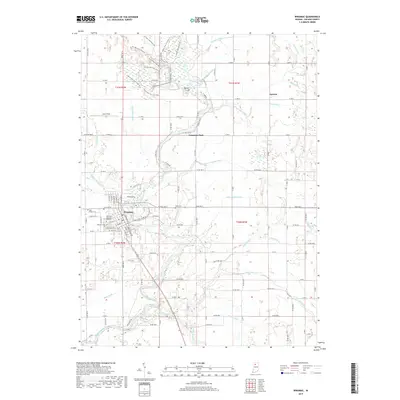
2019 Map of Winamac
USGS Topo · Published 2019About this map
The Tippecanoe River meanders south through the heart of Pulaski County, anchoring the town of Winamac. This river corridor defines the local geography, surrounded by an intricate network of drainage systems such as Quigley Marsh Ditch and Thompson Ditch that transformed the native wetlands into productive farmland. To the north, the landscape shifts toward recreational and conservation use, where Vanmeter Park and a complex system of hiking paths, including the Pin Oak Trail (Trail #1) and The Barrens Trail (Trail #8), navigate the sandy ridges and low-lying oxbows near Bunker Hill. The town itself is marked by local landmarks like McKinley Memorial Gardens and Saint Peters Cem, while the small settlement of Lawton sits to the northeast near the Bruce Lake Outlet.
Find a feature on this map
73 named features on this map. Tap any name to fly to it.
Don’t see what you’re looking for? This feature index may not catch every label — zoom into the map to look around manually.
Map Details
Editions of this 2019 Winamac Map
This is the sole edition of this map. No revisions or reprints were ever made.
Other maps of this area

1953 · Chicago
USGS Topo · 1:250,000

1953 · Danville
USGS Topo · 1:250,000

1955 · Danville
USGS Topo · 1:250,000

1956 · Danville
USGS Topo · 1:250,000

1957 · Chicago
USGS Topo · 1:250,000

1960 · Grass Creek
USGS Topo · 1:24,000

1962 · Buffalo
USGS Topo · 1:24,000

1962 · Winamac
USGS Topo · 1:24,000

1962 · Star City
USGS Topo · 1:24,000

1962 · Kewanna
USGS Topo · 1:24,000