
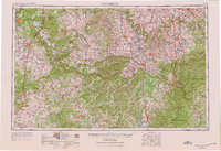
1957 Map of Winchester
USGS Topo · Published 1968About this map
Fort Knox Military Reservation dominates the northwestern corner of this Central Kentucky landscape, surveyed in the 1950s with updates through the late 1960s. The region transitions from the industrial and military hubs around Elizabethtown and Vine Grove into the distinct topographic belts of The Knobs and Muldraugh Hill. To the east, the Kentucky River carves a winding path past Nicholasville and Richmond, while the southern reaches of the map are defined by the massive waters of Lake Cumberland.
Find a feature on this map
62 named features on this map. Tap any name to fly to it.
Don’t see what you’re looking for? This feature index may not catch every label — zoom into the map to look around manually.
Map Details
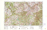
Editions of this 1957 Winchester Map
3 editions found
Other maps of this area

1886 · Cumberland Gap
USGS Topo · 1:125,000

1888 · Cumberland Gap
USGS Topo · 1:125,000

1890 · Williamsburg
USGS Topo · 1:125,000

1891 · Manchester
USGS Topo · 1:125,000

1891 · Cumberland Gap
USGS Topo · 1:125,000

1892 · Richmond
USGS Topo · 1:125,000

1892 · Beattyville
USGS Topo · 1:125,000

1893 · London
USGS Topo · 1:125,000

1894 · Williamsburg
USGS Topo · 1:125,000

1897 · Richmond
USGS Topo · 1:125,000