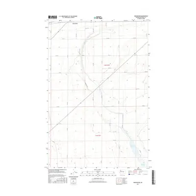
2017 Map of Winchester
USGS Topo · Published 2017About this map
Winchester sits at the northern edge of this high-desert landscape, defined by the stark geometry of the Columbia Basin Project's irrigation and road networks. The terrain is dominated by a grid of agricultural access routes, including Rd 11.1 NW and the diagonal Winchester Rd NW, which trace the development of the region's mid-20th-century water management systems. A critical hydrological feature, the Winchester Wasteway, carves through the southeastern sections of t19n r25e, carrying irrigation runoff across the arid flats. This drainage system is central to the area's transition from shrub-steppe to productive farmland, supporting the surrounding network of section lines and gravel roads like Ditch Rd. The map illustrates the precision of modern land division in Grant County, where every mile is accounted for by numbered roads and drainage canals.
Find a feature on this map
18 named features on this map. Tap any name to fly to it.
Don’t see what you’re looking for? This feature index may not catch every label — zoom into the map to look around manually.
Map Details
Editions of this 2017 Winchester Map
This is the sole edition of this map. No revisions or reprints were ever made.
Other maps of this area

1909 · Quincy
USGS Topo · 1:62,500

1910 · Quincy
USGS Topo · 1:62,500

1910 · Winchester
USGS Topo · 1:62,500

1953 · Ritzville
USGS Topo · 1:250,000

1956 · Ephrata
USGS Topo · 1:62,500

1956 · Ephrata
USGS Topo · 1:24,000

1956 · Ephrata SW
USGS Topo · 1:24,000
1956 · Winchester SE
USGS Topo · 1:24,000

1956 · Winchester NE
USGS Topo · 1:24,000

1959 · Ritzville
USGS Topo · 1:250,000