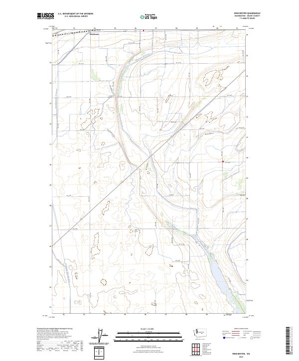
2023 Map of Winchester
USGS Topo · Published 2023About this map
Winchester serves as the primary focal point of this Grant County landscape, characterized by the extensive irrigation and drainage infrastructure of the Columbia Basin Project. The terrain is defined by the Frenchman Hills and the artificial waterways that manage the region's agricultural runoff, specifically the Winchester Wasteway and the Frenchman Hills Wasteway. These features demonstrate the massive scale of 20th-century water management required to transform this arid environment into productive farmland. The map reveals a precise grid of rural routes such as Winchester Rd NW and Ditch Rd, which facilitate access to the surrounding fields and wetlands. This 2023 survey by the U.S. Geological Survey provides an essential perspective on the contemporary state of Washington's managed hydraulic landscapes.
Find a feature on this map
34 named features on this map. Tap any name to fly to it.
Don’t see what you’re looking for? This feature index may not catch every label — zoom into the map to look around manually.
Map Details
Editions of this 2023 Winchester Map
This is the sole edition of this map. No revisions or reprints were ever made.
Other maps of this area

1909 · Quincy
USGS Topo · 1:62,500

1910 · Quincy
USGS Topo · 1:62,500

1910 · Winchester
USGS Topo · 1:62,500

1953 · Ritzville
USGS Topo · 1:250,000

1956 · Ephrata
USGS Topo · 1:62,500

1956 · Ephrata
USGS Topo · 1:24,000

1956 · Ephrata SW
USGS Topo · 1:24,000
1956 · Winchester SE
USGS Topo · 1:24,000

1956 · Winchester NE
USGS Topo · 1:24,000

1959 · Ritzville
USGS Topo · 1:250,000