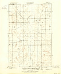
1910 Map of Winchester
USGS Topo · Published 1951About this map
Winchester and the Great Northern RR anchor the northern landscape of this Central Washington territory during the early twentieth century. This survey, conducted just years before the region was transformed by massive irrigation projects, shows a sparsely settled agricultural and ranching environment defined by wide section lines and scattered rural outposts. Small communities such as Morrison provide local hubs for the surrounding homesteads, while the rail line serves as the primary artery for transport and commerce across the plains.
Find a feature on this map
13 named features on this map. Tap any name to fly to it.
Don’t see what you’re looking for? This feature index may not catch every label — zoom into the map to look around manually.
Map Details
Editions of this 1910 Winchester Map
3 editions found
Other maps of this area

1909 · Quincy
USGS Topo · 1:62,500

1910 · Quincy
USGS Topo · 1:62,500

1910 · Winchester
USGS Topo · 1:62,500

1911 · Red Rock
USGS Topo · 1:62,500

1912 · Moses Lake
USGS Topo · 1:62,500

1912 · Beverly
USGS Topo · 1:62,500

1923 · Corfu
USGS Topo · 1:62,500

1950 · Smyrna
USGS Topo · 1:62,500

1951 · Smyrna
USGS Topo · 1:62,500

1951 · Corfu
USGS Topo · 1:62,500