
2017 Map of Winchester NE
USGS Topo · Published 2017About this map
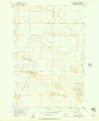
The Pot Hole anchors the northern landscape of this Grant County quadrangle, a distinctive geological depression that stands apart from the surrounding agricultural grid. The area is defined by an extensive network of irrigation infrastructure essential to the region's farming economy, most notably the Canal W-20 which winds through the eastern sections. A rigid system of rural routes, including Dodson Rd N and Kriete Rd, partition the land into precise sections typical of the Columbia Basin Project's influence. This 2017 survey illustrates the intersection of modern hydraulic engineering and traditional land division, where named roads like Canal Rd follow the contours of water delivery systems rather than the cardinal directions of the standard grid. The map provides a detailed view of the localized topography and the complex water management that sustains this part of Washington.
Find a feature on this map
30 named features on this map. Tap any name to fly to it.
Don’t see what you’re looking for? This feature index may not catch every label — zoom into the map to look around manually.
Map Details
Editions of this 2017 Winchester NE Map
This is the sole edition of this map. No revisions or reprints were ever made.
Other maps of this area

1910 · Winchester
USGS Topo · 1:62,500

1912 · Moses Lake
USGS Topo · 1:62,500

1953 · Ritzville
USGS Topo · 1:250,000

1956 · Ephrata
USGS Topo · 1:62,500

1956 · Ephrata
USGS Topo · 1:24,000

1956 · Ephrata SW
USGS Topo · 1:24,000

1956 · Grant Orchards
USGS Topo · 1:24,000

1956 · Mae
USGS Topo · 1:24,000
1956 · Winchester SE
USGS Topo · 1:24,000

1956 · Winchester NE
USGS Topo · 1:24,000